Libraries in Radnor and Lower Merion have no clips on the building.
The Montgomery and Scott families, beneficiaries of the Ardrosson Trust, which has owned the building and land around it since 1912, cannot shed much on the schoolhouse’s lineage.
But Ruth Barnett, a charming blue-eyed widow who has lived nearly all her 77 years about a mile from the schoolhouse, has some information.
Mrs. Barnett, who used to play at the schoolhouse near Godfrey Road after it closed, recently shared recollections that were passed on to her by friends.
One friend had attended classes in the schoolhouse at the turn of the century.
“My twin sister’s aunt by marriage, Florence Fritz, told me a long time ago that they use to sit in old-fashioned desks with inkwells,” Mrs. Barnett said. “There were benches along the side of the room, and the teacher use to sit at a desk that was on a platform so she could see over the class. They had about 12 to 15 students in the class, Flo said.”
Even though the class was small by today’s standards, occasionally a student would fail to toe the line, Mrs. Barnett said, and was exiled to the corner on a high chair, the part of a classroom known then as the dunce’s corner.
“There was one student in one grade and a few in other grades,” Mrs. Barnett said.
The old schoolhouse, with its windows protected by wooden shutters, also had a bell, Mrs. Barnett said.
“There was a bell on the roof and we used to ring it once or twice when we
went down there to play,” she said, bursting with a smile. “My daddy, who worked for the Montgomerys, didn’t know it because he didn’t want us to be playing there.”
Inside, on one side of the wall, was a coal-burning stove, Mrs. Barnett said, and a cloak room – now called a closet – on the other side near the
entrance. The floor was wood.
The schoolhouse also had a basement with a dirt floor, which has remained unchanged since.
There is some doubt as to the closing of the old schoolhouse.
“I talked to my brother, John Russell, who is 80, and he’s pretty sure it
closed in 1912,” Mrs. Barnett said. “They didn’t have too many students to keep it open and all the remaining transferred to Wayne.”
A spokeswoman for R. Alexander Montgomery, a beneficiary of the Ardrosson Trust, said he thought the school was closed in 1920 and the students were absorbed by the Wayne Elementary School.
Harry Ashjean, researcher at the Radnor Memorial Library, said data indicated the population in the southern part of the township was about 500 at the turn of the century.
“You have to remember,” Ashjean said, “that in those days there were large farms operating then, some big estates and few people.”
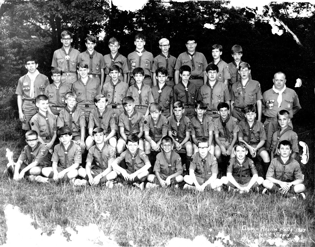
The schoolhouse, however, is still being used – as a meeting room by the Boy Scouts of Radnor Troop 284. The scouts lease the building for $1 a year
from the trust and meet there regularly on Saturday mornings during the fall and spring.
“In June we hold our annual roundup when we induct our Eagle Scouts,” said assistant scoutmaster Eric Sorkin.
The scouts have been holding meetings at the schoolhouse since the 1950s, and all during that time have maintained the building, repairing the roof and pointing the exterior stone. The scouts also take care of the grounds.
Although few historical facts are known of the schoolhouse, there is no scarcity of people fascinated by it, said Ed Mimnaugh, 80, who has worked at Ardrosson since 1933.
“Not a year has passed since I’ve been here that somebody didn’t want to buy that schoolhouse,” he said.
Radnor Historical Society 1955: Report of Mills of Skunk Hollow by Radnor 1 B.S.A.
rhsbulletin-1-5-1955
THE OLD MILLS OF RADNOR 1955 with Radnor 1
The beauty of the countryside along Darby-Paoli Road and the adjacent roads gives little hint of the industry which at one time flourished along the Darby Creeks. Today we see beautiful, spacious lawns, well cared-for farms and delightful woodlands. Sixty years and more ago we would have found strategically placed mills. Grist mills, saw mills, plaster mills, bark mills, tan yards, fulling mills, clover mills, tilt mills, paper mills, cotton mills and cider mills and their related blacksmith, wheelwright and other workshops were all actively engaged in filling the needs of the local citizenry as well as orders from foreign lands. Although these mills were not operating concur- rently, some can trace their history back to the 18th century, and the mills of Tryon Lewis can claim the grist mill of William Davis which dates back to 1710, as their progenitor. Amid this scene of industry would be seen farm wagons lumbering to and from the mills, laden with raw material or finished products.
Until a year ago, I considered “Skunk Hollow” simply a pleasant picnic grove on Little Darby Creek across from “Ardrossan Farm.” Now I know that it was once the scene of a thriving industrial community boasting two mills, a wheelwright shop, a blacksmith shop, the miller’s home and the workers’ homes. This sudden increase in my knowledge was the direct result of an invitation from James Dallett to Radnor Boy Scout Troop No. 1 to explore Darby and Little Darby Creeks for the remains of former mill sites and dams.
Starting with suggestions from Mr. Dallett, we located ten dams and several mill races. With this information and that gleaned from the memory of those whose lives go back many years, we were able to map out the approximate location of many of the mill sites. It would be nice to say that we had the same kind of cooperation from the elements but such was not the case as our final operations were greatly hampered by Hurricane “Hazel”.
We will now start on the exploration. Let us gather together at Conestoga Road and Maplewood Road in Wayne. We will proceed along Maplewood Road until we (5) come to the Mill Dam Club. This old white house was at one time the home of Mahlon Edwards who operated a saw mill located between his home and the dam. This mill,which bore on one of its front beams the date 1714, was on land which descended to William Siter who was miller in 1829. Across the dam and immediately to our left was a cider mill. Farmers came from miles around to convert their apples into cider
and subsequently, I suspect, into applejack! (The winters were much colder then!)
About 75? below the dam on the southerly side of the stream are the remains of (13) a tail race which would place the cider mill in a small square area bounded on two sides by what is now the Pemberton property and on the other two by Maplewood Road and the creek. In the ravine below the dam have been found Indian relics.
You who are more venturesome may hike with us down Little Darby Creek to Route No. 252 where we will join the others. Somewhere along this beautiful glen was a small forge or tilt mill built in 1771 by Samuel Brooke (1717-97) and continued by his son John Brooke who made military equipment here during the War of 1812. The power came from the creek which was carried nearly half a mile via a large ditch. The ditch, foundation of the forge and the pit which was blasted in rock for the water wheel, were still to be seen in 1898. Spades, ice skates, parts for cotton gins and other iron products were forged here.
Jesse Brooke <1793-1868), son of John, ran the forge until his death and being an active member of St. David’s Church was known locally as “Church Jesse” to distin- guish him from his first cousin Jesse Brooke (1799-1882) who was called “Miller Jesse.”
We shall visit “Miller Jesse” later. “Church Jesse” Brooke lived in the present W. W. Montgomery farm house facing Church Road between the creek and Brooke Road. (5A)
Traveling down Little Darby Creek, we discover the remains of an earthen
dam a few feet to the north of Darby-Paoli Road and east of Route No. 252. The (4) purpose of this dam is still unknown.
We continue in a southerly direction either along the creek or by Darby-Paoli Road until we come to Saw Mill Road on our right. Here we find the site of what must have been at one time, a thriving industrial community. Considerable engineering skill was called into action, for every stream has been dammed and the water diverted to industrial use. Here Tryon Lewis had his mills. Records of mills operated by mem- bers of the Lewis family on both the “East Branch” and “West Branch” of Darby Creek date back to 1735. As early as 1710 William Davis owned a grist mill which was located on or near the site of the mills operated by Tryon Lewis.
Northwest of the juncture of Saw Mill and Darby-Paoli Roads we can see the remains of a grist mill and dam. This dam and mill were fed with water from both the Darby Creek and Little Darby Creek. Approximately 500? west of its meeting with Little Darby Creek there is a dam on Darby Creek. The water from this dam flows in a northeasterly direction for approximately 900? to Little Darby Creek. Here there is another dam and the overflow serviced a mill pond which was the source of water power for the grist mill. This mill was operated at one time by Eber Siter. Directly in front of the remains of the mill and nearer the corner of the two roads previously mentioned, is the site of the blacksmith shop. One smith was William Epright.
Hugging the east side of Darby-Paoli Road, directly opposite the site of the grist mill, is a one-story, single room stone building once a wheelwright shop, which even in the youth of Tryon Lewis Steele was not in use. That would be around 1870-1880.
At the southwesterly corner of Saw Mill and Darby-Paoli Roads is located a cattle barracks. This spot is the approximate site of “The White Hall,” a narrow three-story, three-dwelling house in which lived the above mentioned Siter, Epright and Charles Fritz, a farm hand, all of whom worked for Tryon Lewis.
We will now go west along Saw Mill Road and turn left into Earle’s Lane. Here we find a fine old two-story stone house, of eighteenth century construction, the home at present of Franklin H. Price. Back in the 1850’s Dilwyn Steele moved here from his home near Goshen Meeting in Chester County. Here he became the manager of Tryon Lewis’ saw mill. Steele, a Quaker, attended Newtown Friends Meeting and was also prominent in the affairs of Radnor Township, serving for many years as Township Supervisor.
Leaving this lovely old home and returning to Saw Mill Road, we find the foundations of a small four-room house, two rooms up and two down. The actual site is located in the woods on the westerly side of the road immediately after it makes a 90-degree turn. Here Tryon Lewis housed various of his itinerant workers or rented it to workers from Garrett’s Paper Mill located on St. Davids Road further west on Darby Creek. Among the persons who rented this house was a man named Wilfong.
If we now go to a spot on Saw Mill Road about 700? south of Darby-Paoli Road and face the home of Mr. Price, we will find in the field to the rear of us, a mill race which brought either additional water or served an overshot wheel on the saw mill. The saw mill was located just off the road and in front of us.
This race is interesting in that for more than 1000? it follows a northwesterly direction along the side of hill, turning almost due west until it merges with a small unnamed stream nestled amidst dense undergrowth. It is difficult today to understand (3A) how the flow from this small dam could have added much power to the operation of the saw mill.
Retracing our steps to Saw Mill Road and to the site of” the former saw mill, we find a large mill race leading in a southwesterly direction to which main source of power. Near the northern end of this dam is found a “Cornerstone” inscribed “Levi Lewis, Lydia Lewis, Tryon Lewis, U S 70.” Would this date the stone as 1846? Here, prior to the War for Independence and for many decades, the Lewises held sway conducting a thriving miller’s business.
Just before we arrived at Saw Mill Road, you may have noticed on your left an old stone house on the “Ardrossan Farm,” known for over 200 years as “The Holly Tree House.” To the left of the front door of this farm house is a holly tree growing from the roots of an ancient holly tree which had lived for hundreds of years and was THE landmark of this section, giving the place its name. Tryon Lewis was proud of it. At the extreme rear of “The Holly Tree House” is a very small house. Both of these houses now are joined together. Here in the 1880’s lived Charles Rezzer, Lewis’ chief farmer.
Tryon L. Steele recalls that in his boyhood the kitchen of this small house was in its original Colonial form. It had an eight-foot crane in the fireplace, large kettles of all kinds, and pewter dishes and utensils in the cupboards and racks around the walls. Mr. Steele can recall Tryon Lewis showing visitors the kitchen of the Rezzer home and telling them that here the farmer’s wife prepared food for the Revolutionary soldiers stationed at “Camp Woods,” a secret outpost for Valley Forge, up the hill on Newtown Road. (The estate is still so named,)
Indeed this farmer’s wife was none other than Tryon Lewis’ grandmother and the daughter of Thomas Thomas. The small farm house was the Thomas home. Thomas Thomas was a member of Radnor Friends Meeting and the first grist miller in the neighborhood. He married Jane Miles <1687-1770). Their daughter, Margaret, married Nathan Lewis who continued operating his father-in-Iaw’s mill. In 1735 Margaret Thomas Lewis made a trip to London as a “Public Friend.” In order to satisfy the curiosity of some of her English friends concerning maize or American corn, then unknown in England, she had her young son Levi Lewis send over a bag of meal, Radnor’s first export to Europe!
On the crest of the hill overlooking this farm house is “Hickory Hall” (Alfred H. Geary), which was the homestead of Tryon Lewis. In the almost identical Federal style mansion on the same tract (now the R. Alexander Montgomery house) lived Lewis’ parents, Levi Lewis and Lydia Evans.
Continuing to backtrack, we descend into the hollow below and walk through a heavily wooded area known 80 years ago as “Shellbark Flat” from the large cluster of shellbark hickory trees here. Continuing west on the unpaved portion of Paper Mill Road, we cross the township line into Newtown Township. Just at this point we enter a tract of 80 acres of land sold in 1835 by Adam Siter to Samuel, James and Alexander Moore, and on which the Moores erected a stone paper mill described as 40? x 60? and 3 stories in height, and also a one-story stone picker house. The Moores built 14 tenement houses and maintained a large business until 1855 when the main mill was destroyed by fire. Tile small one burned a few years later. Dr. Henry Pleasants later acquired this property. We find today, about 500? west of the township line and north of the road, the beautiful, ivy clad remains of a two-story stone mill, 70? x 34? and with a wall thickness in a low archway of 42?! A mill race comes into it at the top and it is plain where the overflow from the wheel went. Although this mill has been thought to have been part of the Lewis domain, and despite a slight disparity in measurements, it seems almost certain that it is in fact the remains of the Moore establishment, which was the largest in Newtown Township.
Just before we arrived at Saw Mill Road, you may have noticed on your left an old stone house on the “Ardrossan Farm,” known for over 200 years as “The Holly Tree House.” To the left of the front door of this farm house is a holly tree growing from the roots of an ancient holly tree which had lived for hundreds of years and was THE landmark of this section, giving the place its name. Tryon Lewis was proud of it. At the extreme rear of “The Holly Tree House” is a very small house. Both of these houses now are joined together. Here in the 1880’s lived Charles Rezzer, Lewis’ chief farmer.
Tryon L. Steele recalls that in his boyhood the kitchen of this small house was in its original Colonial form. It had an eight-foot crane in the fireplace, large kettles of all kinds, and pewter dishes and utensils in the cupboards and racks around the walls. Mr. Steele can recall Tryon Lewis showing visitors the kitchen of the Rezzer home and telling them that here the farmer’s wife prepared food for the Revolutionary soldiers stationed at “Camp Woods,” a secret outpost for Valley Forge, up the hill on Newtown Road. (The estate is still so named,)
Indeed this farmer’s wife was none other than Tryon Lewis’ grandmother and the daughter of Thomas Thomas. The small farm house was the Thomas home. Thomas Thomas was a member of Radnor Friends Meeting and the first grist miller in the neighborhood. He married Jane Miles <1687-1770). Their daughter, Margaret, married Nathan Lewis who continued operating his father-in-Iaw’s mill. In 1735 Margaret Thomas Lewis made a trip to London as a “Public Friend.” In order to satisfy the curiosity of some of her English friends concerning maize or American corn, then unknown in England, she had her young son Levi Lewis send over a bag of meal, Radnor’s first export to Europe!
On the crest of the hill overlooking this farm house is “Hickory Hall” (Alfred H. Geary), which was the homestead of Tryon Lewis. In the almost identical Federal style mansion on the same tract (now the R. Alexander Montgomery house) lived Lewis’ parents, Levi Lewis and Lydia Evans.
Continuing to backtrack, we descend into the hollow below and walk through a heavily wooded area known 80 years ago as “Shellbark Flat” from the large cluster of shellbark hickory trees here. Continuing west on the unpaved portion of Paper Mill Road, we cross the township line into Newtown Township. Just at this point we enter a tract of 80 acres of land sold in 1835 by Adam Siter to Samuel, James and Alexander Moore, and on which the Moores erected a stone paper mill described as 40? x 60? and 3 stories in height, and also a one-story stone picker house. The Moores built 14 tenement houses and maintained a large business until 1855 when the main mill was destroyed by fire. Tile small one burned a few years later. Dr. Henry Pleasants later acquired this property. We find today, about 500? west of the township line and north of the road, the beautiful, ivy clad remains of a two-story stone mill, 70? x 34? and with a wall
We will now move through the Darby Creek valley and will proceed to the area east of Paper Mill and St. Davids Roads. Here the picture has not become clear. Our exploration in this area was continually handicapped by recent building operations, storms (including both rain storms and Hurricane “Hazel”) as well as rubbish heaps, notto mention areas of dense undergrowth. However, it is known that about 400? northeast William Crosley as a woolen factory. This building burned. It was purchased in 1861by Dr. Henry Pleasants and then sold by him to Caspar C. Garrett. Garrett owned many mills in Delaware County, the foremost being the “Keystone Mill” in Upper Darby,and under his management the “Union Paper Mill,” as it had become, entered upon a period of prosperity. Late in the nineteenth century it was finally abandoned and, according to Mr. George L. Harrison, its machinery shipped to Brazil. Another 50? to the north-east on the westerly side of St. Davids Road is a long low dam which formed a large shallow mill pond. Immediately above the pond was a small stone house which the Harrison family took down, after paying off an ancient $600 yearly dower right on the place. Across the meadow in the background can be seen the white farm buildings and homestead of Major Whiteside (1816-1881), who is buried in Old St. David’s Churchyard. According to Mr. Harrison, this property was sold to his father, Charles Custis Harrison, for $1.00 an acre. The purpose of this dam and pond does not seem clear, for the race which causes a bump in St. Davids Road and hugs the side of the hill seems to have been too small to provide any appreciable amount of water power. Perhaps the water was used in processing paper.
The building which is still standing at the eastern corner of Paper Mill and St. Davids Road, was originally a double house. The section nearest St. Davids Road was the home of the superintendent of the mill, While the southern half was a store to supply the needs of the workers. Immediately below this house on Paper Mill Road, were some fourteen small four-room, two-story stone houses which housed mill workers. The names of some of these mill families were Rudolph, Harrison and Wilfong.
Retracing our path on Paper Mill Road, we come to the A. P. Pakradooni house on the north side of the road and about 150? west of Darby Creek. This house was originally three dwellings and like its twin across the road (which has long since rotted away) was the home of mill workers. It is said that somewhere in this vicinity was located a third mill, which sawed and shipped to Germany fine woods used in the manufacture of toys! You who are adventuresome may wish to explore this area and perhaps do a title search and locate in a more definite fashion some of the missing de- tails of the Moore establishment.
Ithan Creek also had its mills which go back beyond 1826. “Near the head of Ithan Creek in Radnor, a grist mill and saw mill, head and fall about 16 feet grinds from 8-10 thousand bushels of grain per annum and about 50 ton of gypsum per annum.” The saw mill was owned and managed by Jesse Brooke. This Jesse Brooke, to distinguish him from a cousin of like name, was called “Miller Jesse” (1799-1882). This would seem to be the mill later operated by Joseph W. Worrall who lived in the white house with the tall pillars on the east side of Ithan Avenue facing Clyde Road. Going north on Ithan Avenue about 1250? from Clyde Road we come to a drive- way to “IthanMIll Farm,” the home of Mr. Charles J. Rhoads. This drive crosses the old mill dam. The mill race is clearly visible and runs by the side of the hill for about 300? where the grist mill was apparently located. The site of the saw mill is still to be determined, or the mill may have served both purposes.
Clyde Road at one time did not follow its present course but ran through the property of Mr. Rhoads, curving along the front of the house and down through the meadow, fording the creek and up the hill to what is now the Booth School. This house which stands above the site of the mill was originally a two-story, two-room house. At one time it was the home of Enoch Matlack. Mr. Matlack and Edward Thomas of Thomas Nurseries, King of Prussia, had the unique distinction of keeping Radnor Friends Meeting “alive.” Mr. Matlack went to the meeting all alone on Friday afternoons and the local children who played on the grounds thought him very odd to go to church on Friday.
Joseph Worrall, the miller, built in the 1870’s the houses on Radnor Avenue which Mr. Tryon L. Steele thinks was the first real estate speculation in Radnor Township.
On Ithan Creek 250? south of Clyde Road on the property of H. Harrison Smith, is located another mill dam which apparently served “a grist mill and saw mill, head and fall about 23? owned and occupied by John and David Evans,” (about 1826). This mill was located approximately another 400? south of Clyde Road and to the east of the Evans homestead. This would place it between the homestead and the small house on the creek bank which is now in ruins. Lumber for the Philadelphia market was sawed here, and the Evanses also ground grain in their corn mill.
In 1828 John Evans started a Botanical Garden and Arboretum here. He ranked with Bartram and Humphrey Marshall as the third Pennsylvania born naturalist. On the densely wooded hillside north of his home, he planted mountain shrubbery and below, on a flat on the opposite side of Ithan Creek, a “sand garden.” Here were assembled pecan trees, cypress, larch, oriental spruce, magnolia and many other unusual specimens sent to the Radnor miller from Kew Gardens in England, the Andes, Himalayas and all corners of the world. Evans’ collection was the most celebrated in America at the time. The Arboretum was kept up by the W. Hinckle Smith family for some time, but is now much overgrown.
I n the heart of Wayne was located a large cotton mill operated in the 1880’s by “Huts” (Hudson?) Worrall. This mill was located in the area of South Wayne and Audubon Avenues, in what is now a heavily-built residential area.
Our trek is now ended, but the work is not completed. Much can still be done to pinpoint and authenticate what has been written here. This has been an interesting venture and a most satisfying experience. In view of the history of “Radnor Valley” and its importance to the early life of Radnor, it would be grand if it could be turned into a Darby Creek Conservation Area. It would thus aid in preserving a great deal of our early history, it would aid in the conservation of our wildlife and botany and provide a place for wholesome recreation for all residents.
May I express my appreciation to the boys of Radnor No. I, B.S.A., for their field work, to Francis James Dallett, Jr., for his valuable suggestions and historical sketches, to the Radnor Historical Society which has provided data from Henry Graham Ashmead’s History of Delaware County, Pennsylvania, and from Thomas Allen Glenn’s Merion in the Welsh Tract, and to George L. Harrison, the sponsor of the project.
ALBERT N. CURLEY, Wayne, Pa.
EXPLANATION OF NUMBERS ON ENLARGED MAP
Mill Dams and Sites Located on Little Darby, Darby and Ithan Creeks
(1) Dam located near corner of Saw Mill Road and Darby-Paoli Road. This dam is fed by an overflow stream starting at a dam (#2) located approximately 600? to the north on Little Darby Creek; also site of grist mill.
(2) Dam on Little Darby Creek approximately 800? in a northerly direction from Saw Mill Road. This dam is also fed by a mill race leading from a dam on Darby Creek (2A) as well as providing water for dam (#1).
(2A) Dam on Darby Creek approximately 500? from its juncture with Little Darby Creek. This dam provides additional water for the dam (#2) on Little Darby Creek by means of a mill race which runs along the base of hill.
(3) Dam located on Price property (at corner of Earle’s Lane and Saw Mill Road) approximately 600? to the northeast of Earle’s Lake. A cornerstone in the dam is inscribed “Levi Lewis, Lydia Lewis, Tyron Lewis U S 70.”
(3A) Dam located on unnamed stream which empties into Darby Creek approximately 200? west of dam (#2A). This dam feeds a mill race which runs along the side of a hill for approximately 1000? toward the mill site on the Price property. Probably this race have led to an overshot wheel.
(4) Earthen dam on Little Darby Creek at corner of Brooke Road and Darby-Paoli Road.
(5) Dam located on Little Darby Creek at corner of West Wayne Avenue and Maple- wood Road. This is now the site of the “Mill Dam Club.”
(6,7) Earthen dams on Darby Creek near Paper Mill Road about 1000? to 1200? south- east of St. Davids Road.
(8) Shallow mill pond along St. Davids Road about BOO’ northeast of the corner of St. Davids and Paper Mill Roads. It is apparent that the dam extended across St. Davids Road.
(9) Miller’s house at the corner of Paper Mill and St. Davids Road.
(10) Miller’s house at the corner of Earle’s Lane and Saw Mill Road. (Price)
(11) Wheelwright shop located on east side of Darby-Paoli Road near Saw Mill Road opposite Dam #1.
(12) Mill ruin on Paper Mill Road about 2000? west of Darby-Paoli Road. This mill Is to the north of Darby Creek. We did not locate the water supply for this mill. It is set higher than the dams (#6) and (#7).
13) Possible site of Mahlon Edward’s .cider mill.
(14) Site of Lewis’ blacksmith shop.
(15) Site of three-story, three-home dwelling –
(16) Foundation of dwelling for itinerant workers.
(17) Site of saw mill.
18) “The Holly Tree House.”
(19) Garrett mill.
(20) Pakradooni house. ,
(21) Dam on property of Mr. Rhoads (Worrall). (22) Site of mill (Worrall).
(23) Worrall house.
(24) Evans’ dam.
(25) Site of Mill.
(26) Evans’ house.
(27) ,Rhoads house (Matlack).
(Submitted May 11,1954 from information gathered,by the boys of Radnor No.1, B. S. A.)


